How Healthy Are Our Watersheds?
Ways to Protect Our Watersheds
Stream Buffers
-Riparian Buffer & Rain Garden
-Buffer Handbook
-Sources of native plants
Upper Thornton River Watershed Study
RappFLOW is a member of the Orion Grassroots Network
People, Land and Water at the
Headwaters of the
Rappahannock River Basin
11 Least-protected subwatersheds: White Walnut Run
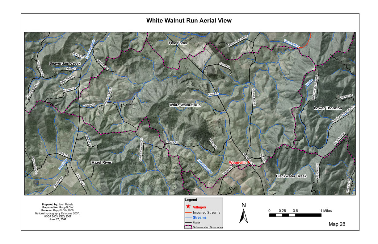
White Walnut Run is an area a little less than eight square miles, north of Woodville. It is bisected by Sperryville Pike on the north-south axis, and Yancey Road bisects the watershed going east-west. Portions of the FT Valley Road run through the western side of the watershed, and portions of Rudasill Mill Road are on the eastern side. See Map 28: White Walnut Run Aerial photo.
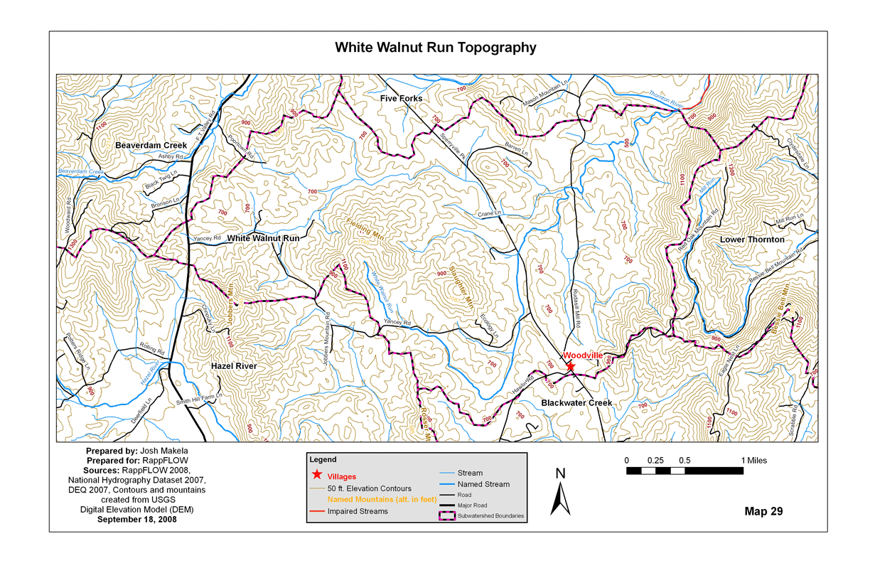
Map 29 shows the topography. The lowest elevation, about 500 feet, is where the White Walnut Run joins the Thornton River on the northwest edge of Red Oak Mountain. The highest point is the top of Red Oak Mountain at 1400 feet. Portions of Fielding, Red Oak, Mason, Slaughter, and Jobbers mountains are in the White Walnut Run subwatershed.
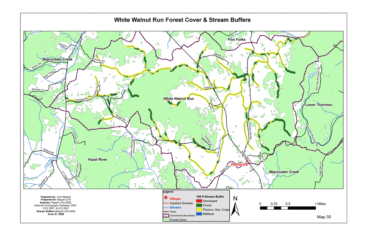
In White Walnut Run, about 42 percent of the land is forested. This is the lowest percentage of forested land cover of any of the subwatersheds. Fifty-seven percent of the land cover is hay/pasture. Twenty-six percent of the 100-foot stream buffer area is forested. This is the lowest stream buffer percentage of all the subwatersheds in the county. (See Maps 30: White Walnut Run Forest Cover and 31: Stream Buffer Vegetation.)
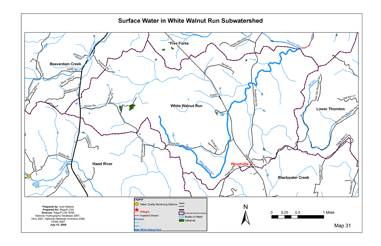
There are about 21 miles of streams in this subwatershed, all of which are tributaries to the White Walnut Run. White Walnut Run joins the Thornton River at the subwatershed boundary near Red Oak Mountain. At that point, the Thornton River is designated “303d Impaired” for E. coli by the Department of Environmental Quality. There are no DEQ monitoring stations either before or after the confluence of White Walnut Run and the Thornton River, so the water quality in White Walnut Run is not known at this time. See Map 31: White Walnut Run Surface Water.
About 452 acres, or 8.9 percent of land in White Walnut Run were in VOF easement as of early 2008. By comparison, for the county overall the percentage is nearly 20. Map 32 shows the land in easement.
Red Oak Valley is a large Agricultural/Forestal District on the eastern side of the subwatershed. Map 33 shows the Ag/Forestal Districts.
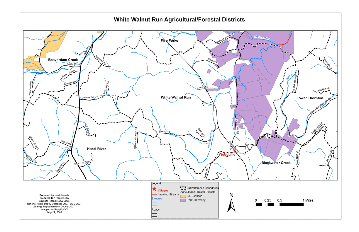
About 39 percent of land in White Walnut Run is in highly erodible soils on nonforested land. This is the highest percentage of all the subwatersheds. Map 34 shows these areas.
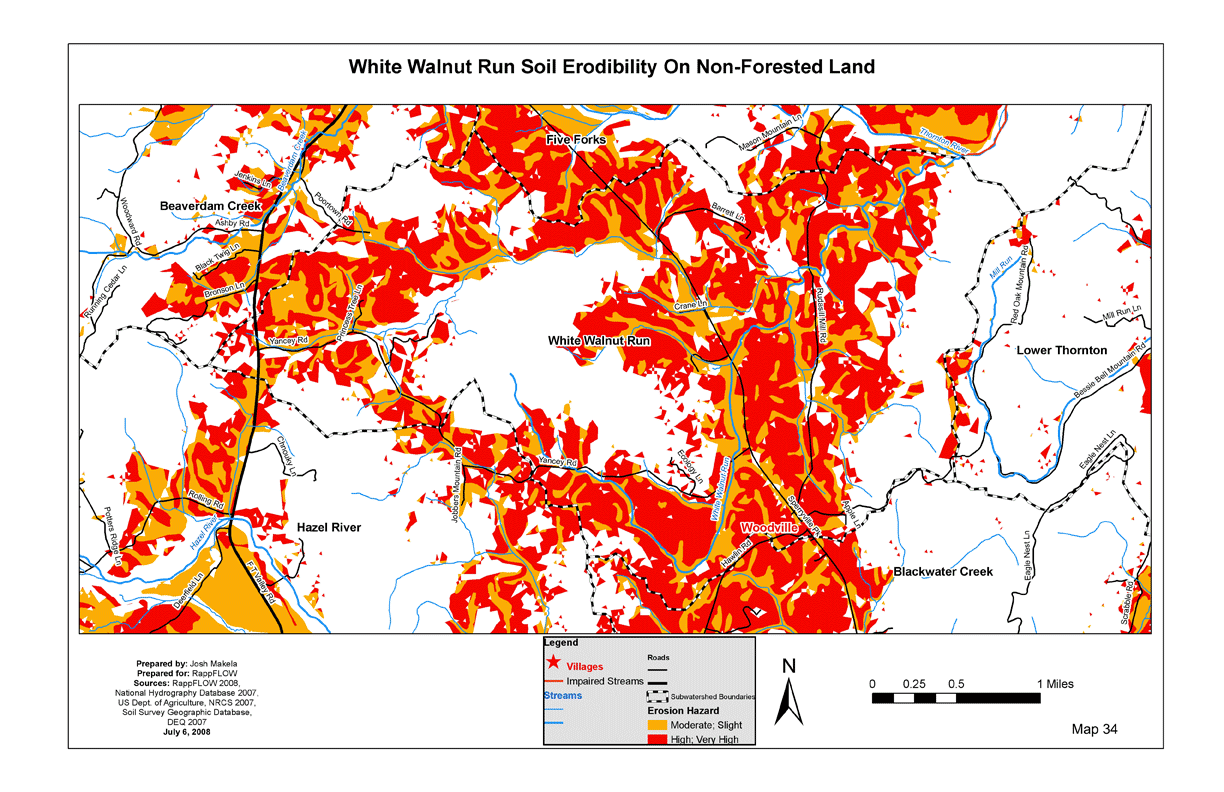
Nearly 99 percent of land in White Walnut Run is in Agricultural or Conservation Zoning. A small area of Woodville is zoned residential. Map 35 shows the zoning.
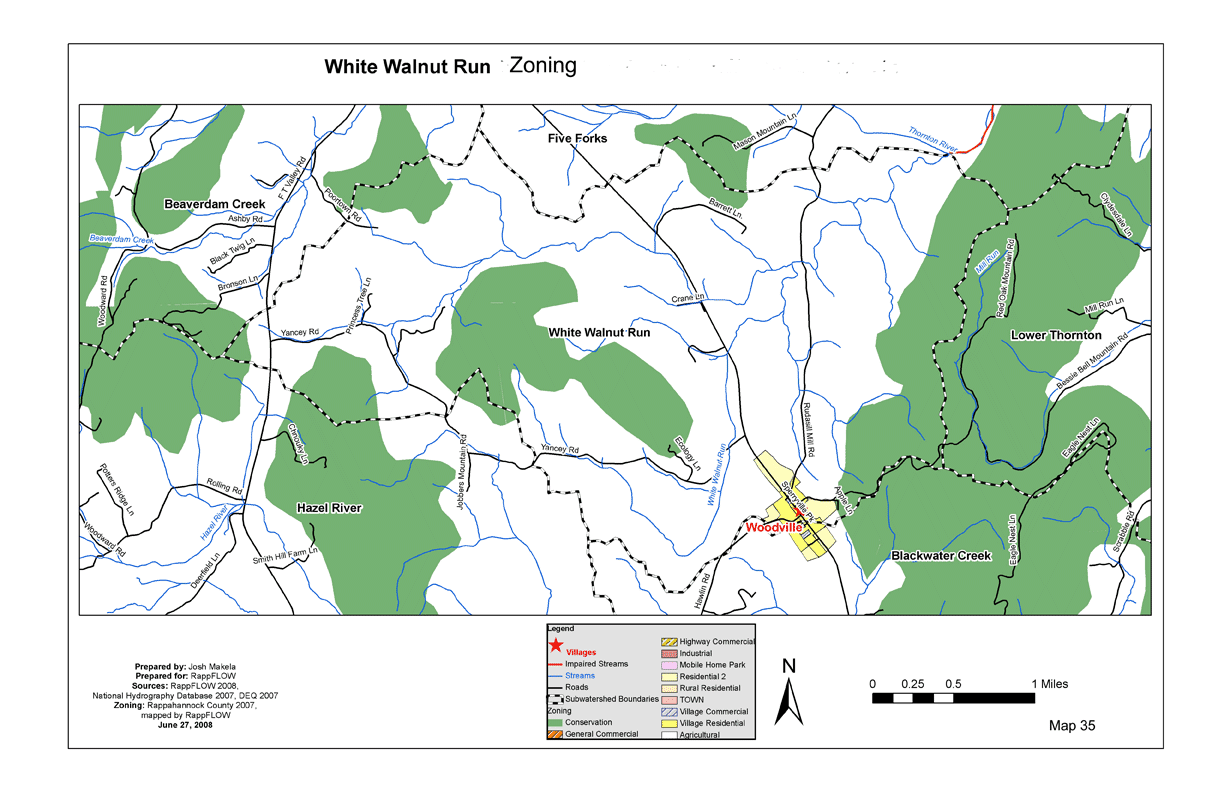
Next: Least-protected subwatersheds:
Upper Battle Run
Back to TOC